PAVLOPETRI - GREECE


OCEAN AWARENESS - UNDERWATER ARCHAEOLOGY


Please use our A-Z INDEX to navigate this site or return HOME


RACE AGAINST TIME: Ocean levels are rising as the Arctic and Antarctic ice caps melt from being warmed due to climate change. Today islands are sinking as we write. That is the legacy that we are creating, and must do our utmost to undo.


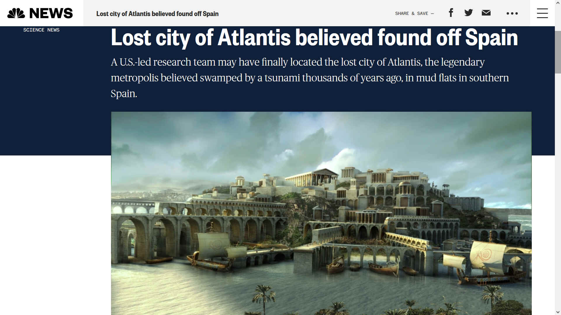
In 1967 an oceanographer discovered what looked like ancient ruins and a year later a survey produced a plan of a prehistoric town thought to be Mycenaean, lying in three to 12 feet of water in the Peloponnese, in south-western Greece. Pavlopetri, named after a nearby settlement, has since been touted as the oldest underwater city, dating to the Bronze Age, and occupied from the third millennium until 1100 B.C. Located steps away from a sandy beach, it is a miracle that it is in such good condition.


You can see it for yourself by donning a wet suit and diving into Inner Space.


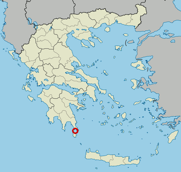
LOCATION MAP: Greece and Crete, with Pavlopetri shown in red.


The city of Pavlopetri (Greek: Παυλοπέτρι), underwater off the coast of southern Laconia in Peloponnese, Greece, is about 5,000 years old, making it one of the oldest submerged lost cities, as well as the oldest in the Mediterranean sea. Pavlopetri is unique in having an almost complete town plan, including streets, buildings, and tombs. 

The city of Pavlopetri is part of the underwater cultural heritage as defined by the UNESCO in the UNESCO Convention on the Protection of the Underwater Cultural Heritage. All traces of human existence underwater which are one hundred years old or more are protected by the UNESCO Convention on the Protection of the Underwater Cultural Heritage. This convention aims at preventing the destruction or loss of historic and cultural information and looting. It helps states' parties to protect their underwater cultural heritage with an international legal framework.

DISCOVERY

The remains were discovered in 1967 by Nicholas Flemming and mapped in 1968 by a team of archaeologists from Cambridge, Pavlopetri is located between the islet of Pavlopetri and the Pounta coast of Laconia on the Peloponnese peninsula. The site is northeast of the village on the island of Elafonisos. The archeological site as well as the islet and the surrounding sea area are within the region of the Elafonisos Municipality, the old "Onou Gnathos" peninsula (according to Pausanias). 

Originally, the ruins were dated to the Mycenaean period, 1600–1100 BCE but later studies showed an older occupation date starting no later than 2800 BCE, so it also includes early Bronze Age middle Minoan and transitional material. It is now believed that the town was submerged around 1000 BCE by the first of three earthquakes that the area suffered. The area never re-emerged, so it was neither built-over nor disrupted by agriculture. Although eroded over the centuries, the town layout is as it was thousands of years ago. The site is under threat of damage by boats dragging anchors, as well as by tourists and souvenir hunters.

The fieldwork of 2009 was largely to map the site. It is the first submerged town digitally surveyed in three dimensions. Sonar mapping techniques developed by military and oil prospecting organizations have aided recent work. The city has at least 15 buildings submerged in 3 to 4 metres (9.8–13.1 ft) of water. The newest discoveries in 2009 alone cover 9,000 m2 (2.2 acres).

Four more fieldwork sessions were planned in October 2009, in collaboration with the Greek government as a joint project aimed at excavations. Also working alongside the archaeologists (from the University of Nottingham) are a team from the Australian Centre for Field Robotics, who aim to take underwater archaeology into the 21st century. Several unique robots have been developed to survey the site in various ways. One of the results of the survey was to establish that the town was the centre of a thriving textile industry (from the many loom weights found in the site). Also many large pitharis pots (pottery jars) from Crete were excavated, indicating a major trading port.


Ocean literacy could be taught in schools, as part of an educational curriculum to raise awareness of just how important the subsea kingdom is for land dwellers.


What lost treasures might we discover as the mysteries of the deep unfold, armed with new underwater technology and an army of freshly educated researchers with an interest in the deep.


ATLANTIS - MEDITERRANEAN SEA

ATLIT-YAM - ISRAEL

BAIA - ITALY
DWARKA - INDIA

PAVLOPETRI - GREECE
PHANAGORIA - BLACK SEA
PORT ROYAL - JAMAICA

RUNGHOLT - DENMARK
THONIS-HERACLEION AND ALEXANDRIA - EGYPT

YONAGUNI JIMA - JAPAN


REFERENCE


https://www.


Copyright logo JVH2 humpback whales broaching for joy


Please use our A-Z INDEX to navigate this site


  THE SUBMERGED PAVLOPETRI IS NEAR LACONIA IN THE MEDITERRANEAN SEA


This website is Copyright © 2022 Jameson Hunter & Cleaner Ocean Foundation Ltd, equal opportunities companies. This website is carbon friendly, using less energy to load on average per page via simplicity & picture optimization. The same may not apply to third party links.