|
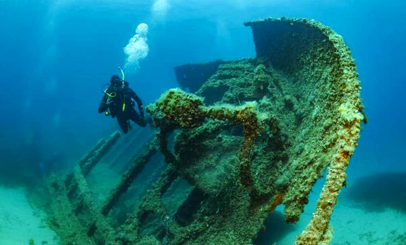
The city of Dwarka, or “Gateway to Heaven,” was discovered submerged some 100-feet below the Gulf of Cambay in
1988, in the Arabian
Sea.
Ancient structures, pillars, grids of a city, and ancient artifacts were found. Steeped in mystery, some believe them to be at least 10,000 years old, others say they could be 5,000 years of age, yet others are sure that they date from the Middle Ages. Yet, others claim that in 1473 the Gujarat Sultan Mahmud Begada attacked the city and destroyed the temple of Dwarka. Either way, this is a true underwater city, long lost, full of mystery,
legend, and it is magnificent.
Legends say Dwarka was sunk because of Gandhari’s curse that Dwarka city was destroyed and submerged into the sea. Gandhari was Duryodhan’s mother and King Dhritlashtra’s wife. She was very upset after the death of her 100 sons in the battle of Mahabharat.
Many experts and scientists who have been researching on Dwarka for years. Experts such as Y S Rawat, the former director of the state archaeological department, claim that a tsunami struck 3500 years ago, submerging numerous cities including Dwarka. A marine scientist discovered remnants of an underwater civilization near the coast of Dwarka in the 1970s.
Following that, in the year 2002, scientists discovered an extremely advanced civilization of an ancient past lying untouched beneath the ocean’s surface. With the help of sound matrix, image technology and sub bottom profiling marine scientists were able to find the exact location of the city including some stone structures. The lost city of Dwarka was found 120 feet underwater in the Gulf of Cambay/Cambhat off the western coast of India. The total length of the city is 7 to 8 kms and it is 3 to 4 kms wide. After carbon testing this city, it was found that this city is between 7000-9500 Years old.
The most amazing thing about this underwater city is that all the human remains are still intact. Dwarka has been mentioned in Indian ancient scriptures and because it is also linked to Lord Krishna’s life, many people have been interested in knowing the facts. Even the scientists are doing research have been very surprised with the findings.
Scientists had divided Dwarka into two parts. Bet Dwarka is the area near the water’s surface where Lord Krishna is said to have lived with his family. Dwarka is also known as Shankhodhara. “Shankh” means conch, and scientists discovered many artefacts made of conch shell while conducting research. In this excavation of Dwarka many mud vessels, temple bells, artifacts were found. These artefacts appear to be from a temple or city, and carbon dating indicates that they date from 7,200 BC, or the Prehistoric period.
At the time of research scientists also found a massive man made wall of about 550 Meters, that has been unearthed at the time of low tide and can be easily seen.
Experts claims that some portion near Bet-Dwarka which is now underwater was submerged into the water at a later stage, but not at the same time as the main city of Dwarka.
Through research it was found that because this area was very near to the coast there have been signs of recent construction there, and it goes back to as recent as around 3500 to 1500 BC similar to the time of the late Harappan civilization. The main Dwarka city is still underwater in 2 or 3 kms deep into the sea. It is believed that this is from where Lord Krishna administered his kingdom. It is revealed from the carbon dating of artifacts found here that it is almost 7500-9000 years old and went underwater due to a 5000 year old tsunami.
Many big stone structures were found through archaeological explorations, shapes of which were semicircular, rectangular and square. Besides this big stone structures, big sandstone walls, well laid out architectural structures were also found. Road structures and stone anchors were also found. Something to ponder about Friends, All these artifacts were found in a distance of 7-9 kms, which gives us enough proof that Dwarka was not only a well established city but also a very busy port.
The archaeologists found many copper bells, vessels there which may used for ritualistic purposes. They also found some strange structures made of iron near Dwarka which have been sent to a lab in for further testing.
The first excavation were in 1930, then 1970. The most recent investigation began in 2002, with scientists using more equipment than in 1970, and they discovered plenty of unexpected and astonishing revelations, but this exploration was also halted by the central government. The world still doesn’t know the complete story of Dwarka.
You
can explore this magical Inner
Space by donning a wet suit and diving into the legend.
THE
GULF OF KHAMBHAT
The Gulf of Khambhat, historically known as the Gulf of Cambay, is a bay on the Arabian Sea
(Western) coast of India, bordering the state of Gujarat just north of Mumbai and Diu Island. The Gulf of Khambhat is about 200 km (120 mi) long, about 20 km (12 mi) wide in the north and up to 70 km (43 mi) wide in the south. Major rivers draining Gujarat are the Narmada, Tapti, Mahi and the Sabarmati, that form estuaries in the gulf.
It divides the Kathiawar Peninsula from the south-eastern part of Gujarat.
It extends 250 km inland, separating the Kathiawar Peninsula from the mainland. The gulf is up to 36 m deep. The Narbada and Tapti rivers flow into it. The tides are mixed, reaching a height of 11.9 m. Port cities on the gulf are Surat (on the Tapti River estuary) and Bhaunagar.
THE
ARABIAN SEA
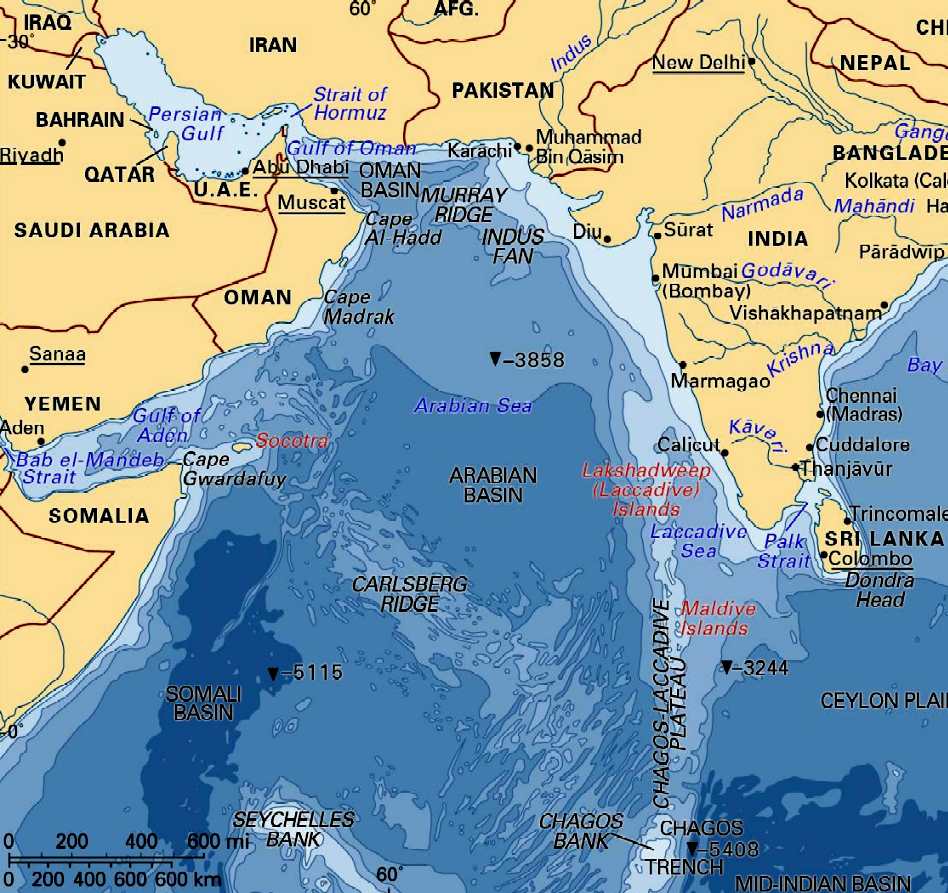
The Arabian Sea is a region of the northern
Indian Ocean bounded on the north by Pakistan and Iran, on the west by northeastern Somalia and the Arabian Peninsula, and on the east by India. An ancient name was the Erythraean Sea and Persian Sea.
The Arabian Sea's surface area is about 3,862,000 km2 (1,491,130 sq mi). The maximum width of the Sea is approximately 2,400 km (1,490 mi), and its maximum depth is 4,652 metres (15,262 ft). The biggest river flowing into the Sea is the Indus River.
The Arabian Sea has two important branches — the Gulf of Aden in the southwest, connecting with the
Red Sea through the strait of Bab-el-Mandeb; and the Gulf of Oman to the northwest, connecting with the
Persian
Gulf. There are also the gulfs of Cambay and Kutch on the Indian coast.
The countries with coastlines on the Arabian Sea are Somalia, Djibouti, Yemen, Oman, Iran, Pakistan, India and the Maldives. There are several large cities on the sea's coast including Karachi, Gwadar, Pasni, Ormara, Aden, Muscat, Mumbai, Keti Bandar, Salalah, Duqm and Kochi.
The Arabian Sea has been referred to by many different names by Arab travelers and European geographers to include: Persian Sea, Sindhu Sagar, Erythraean Sea, Sindh Sea, and Akhzar Sea.
Ocean
literacy
could be taught in schools, as part of an educational
curriculum to raise awareness of just how important the subsea
kingdom is for land dwellers.
What
lost treasures might we discover as the mysteries of the deep unfold,
armed with new underwater technology and an army of freshly educated
researchers with an interest in the deep.
INDIAN
OCEAN
The Indian Ocean is the third largest of the world's oceanic divisions, covering approximately 20% of the water on the Earth's surface. It is bounded by Asia - including India, after which the ocean is named - on the north, on the west by Africa, on the east by Australia, and on the south by the Southern Ocean (or, depending on definition, by Antarctica.)
As one component of the World Ocean, the Indian Ocean is delineated from the Atlantic Ocean by the 20° east meridian running south from Cape Agulhas, and from the
Pacific Ocean by the meridian of 146°55' east. The northernmost extent of the Indian Ocean is approximately 30° north in the
Persian
Gulf. The ocean is nearly 10,000 km (6,200 mi) wide at the southern tips of Africa and Australia, and its area is 73,556,000 km² (28,350,000 mi²), including the Red Sea and the Persian Gulf.
The ocean's volume is estimated to be 292,131,000 km³ (70,086,000 mi³). Small islands dot the continental rims. Island nations within the ocean are Madagascar (the world's fourth largest island), Comoros, Seychelles, Maldives, Mauritius, and Sri Lanka. The archipelago of Indonesia borders the ocean on the east.
ATLANTIS
- MEDITERRANEAN SEA
ATLIT-YAM - ISRAEL
BAIA - ITALY
DWARKA - INDIA
PAVLOPETRI - GREECE
PHANAGORIA - BLACK SEA
PORT ROYAL - JAMAICA
RUNGHOLT
- DENMARK
THONIS-HERACLEION AND ALEXANDRIA - EGYPT
YONAGUNI JIMA - JAPAN
REFERENCE
https://
|